

 한국어
한국어 English
 DRT Ground Control Station
Every moment of flight,
with a smart partner
PX4 ground control software designed by DRT from start to finish.
From pre-flight check to post-landing records, operated the same way on an Android controller and a Windows PC.
Power on,
and it gets ready
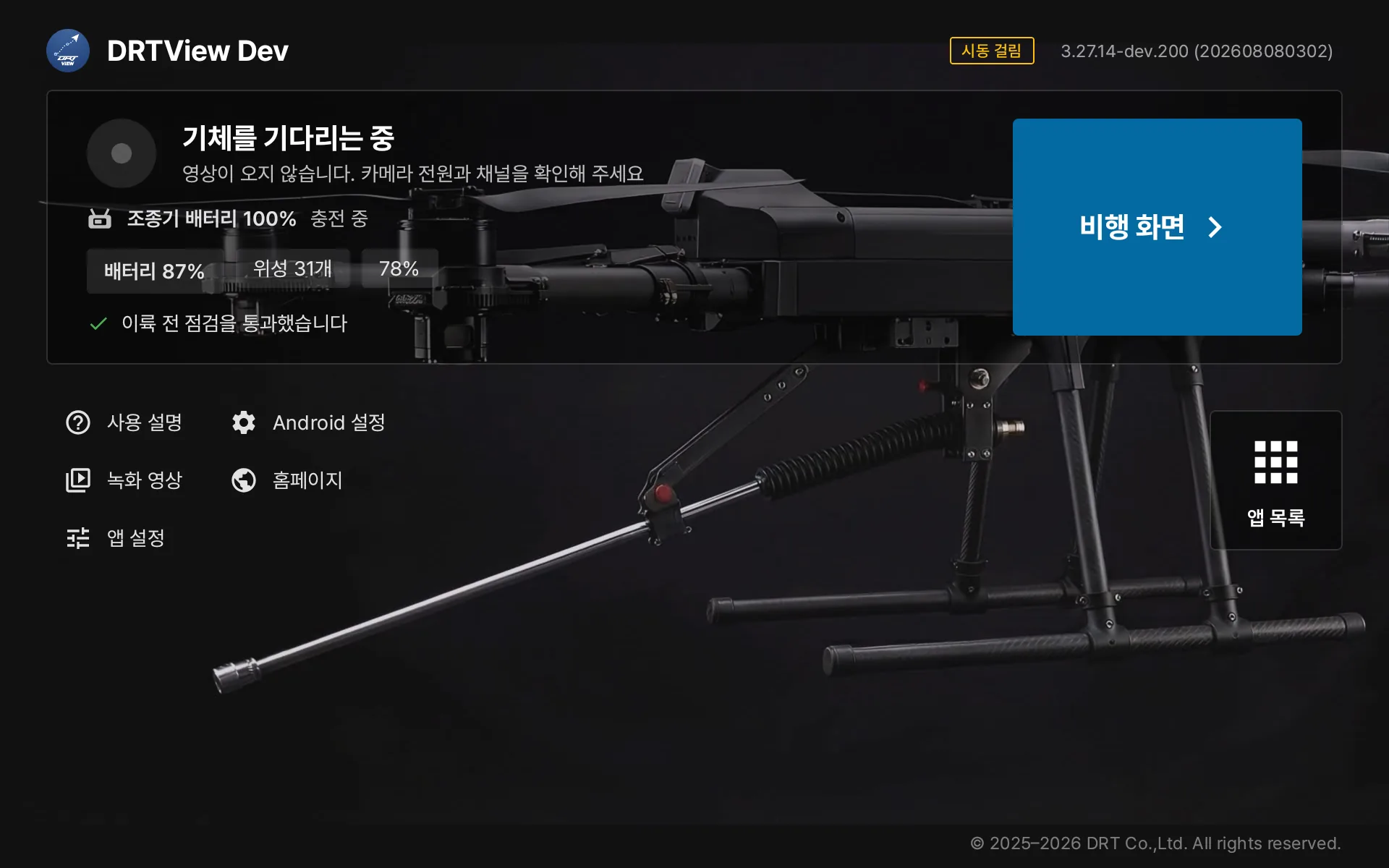
DRTView is the home screen of the controller. Vehicle link, video, battery and satellites are laid out on one screen, you confirm the pre-arm check the aircraft made, and one button starts the flight. App updates, saved videos and bug reports are one tap away.
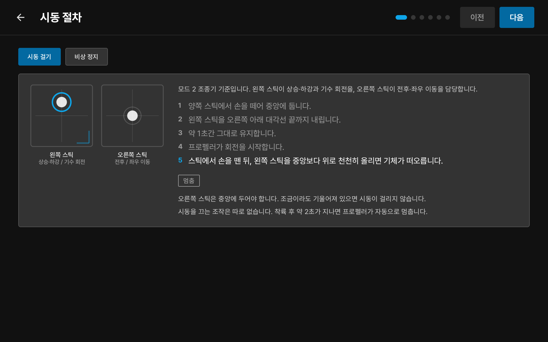
Built-in guide — from arming to warning response, right on the controller.
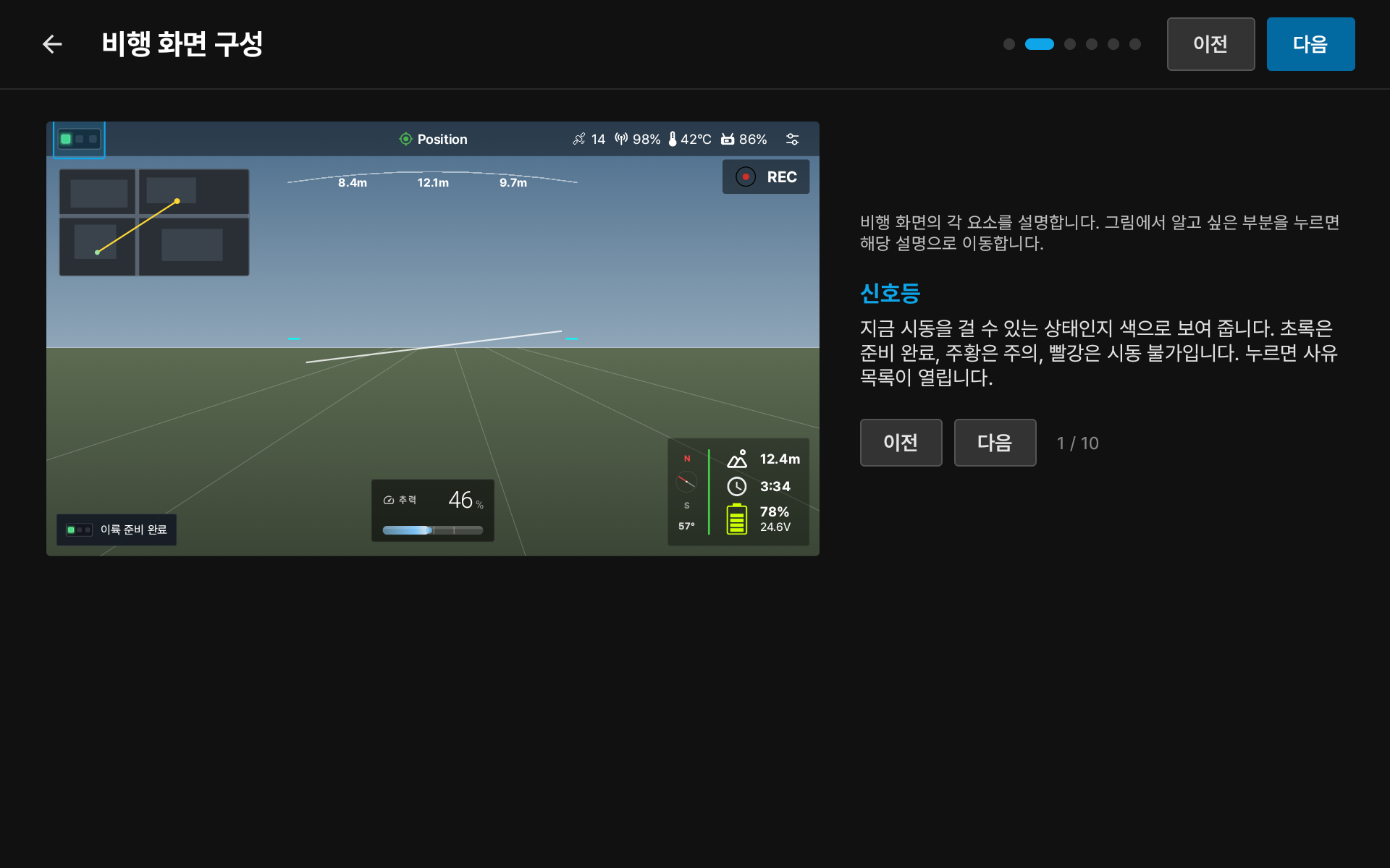
Screen guide — tap any element to learn what it does.
Only what you need,
over the video
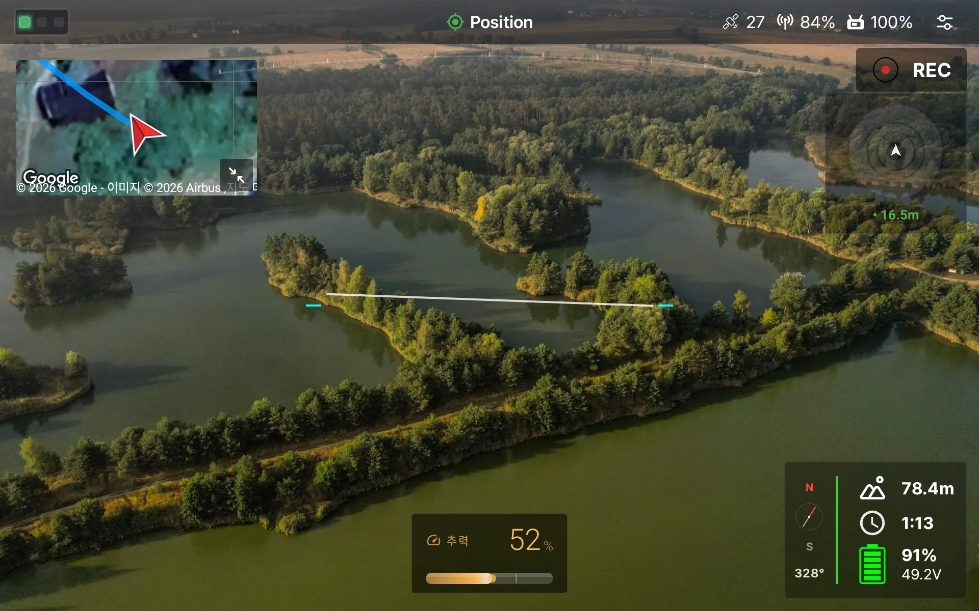
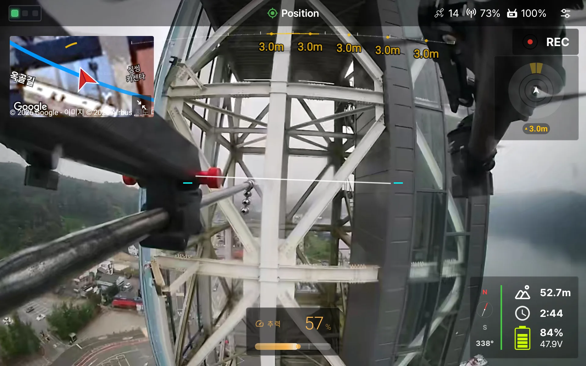
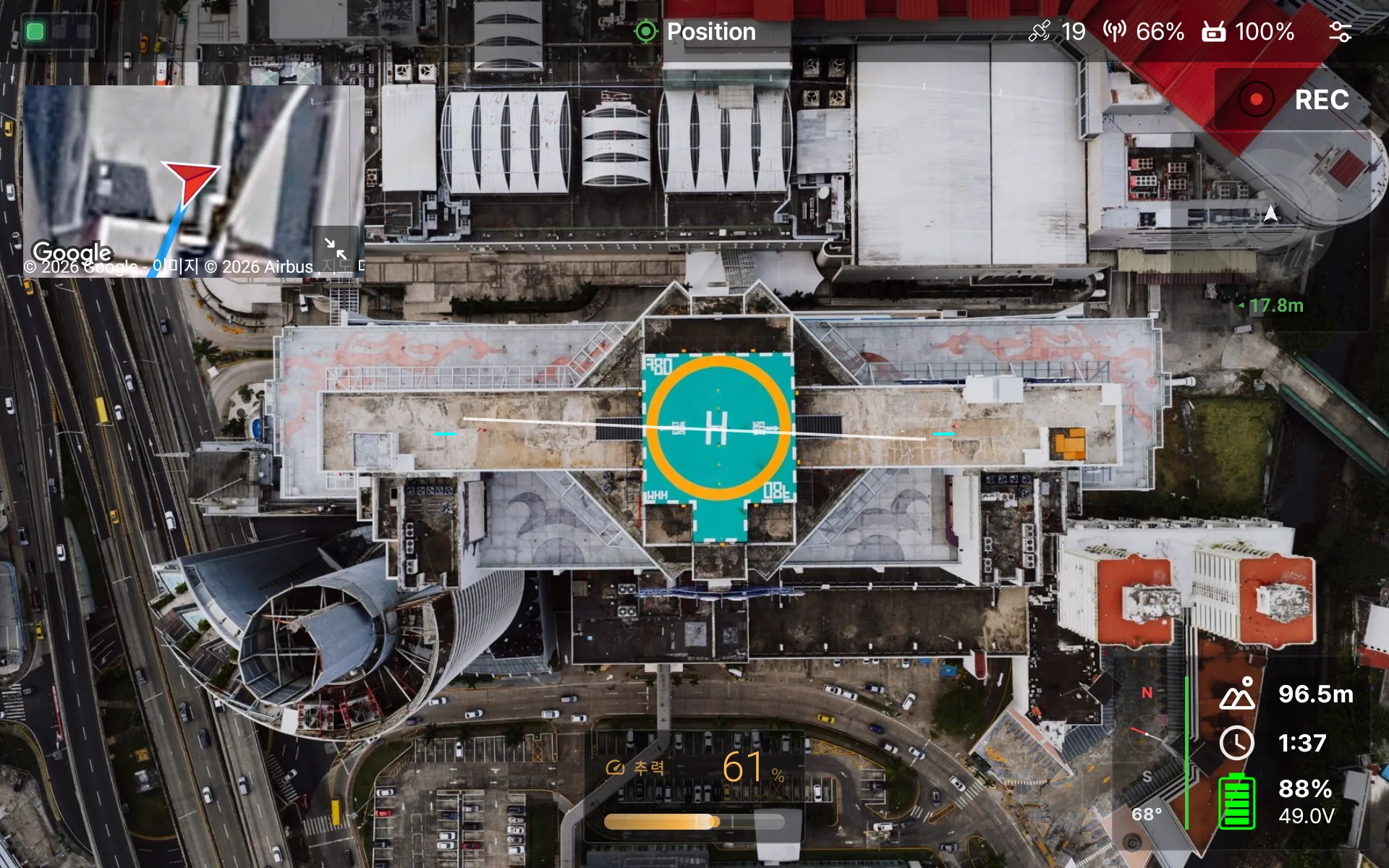
Our own video pipeline draws H.264 and H.265 video with low latency. Altitude, flight time, battery and thrust sit at the edges so your eyes stay on the aircraft. Gimbal and camera controls live on the same screen, and full-quality recording is one button.
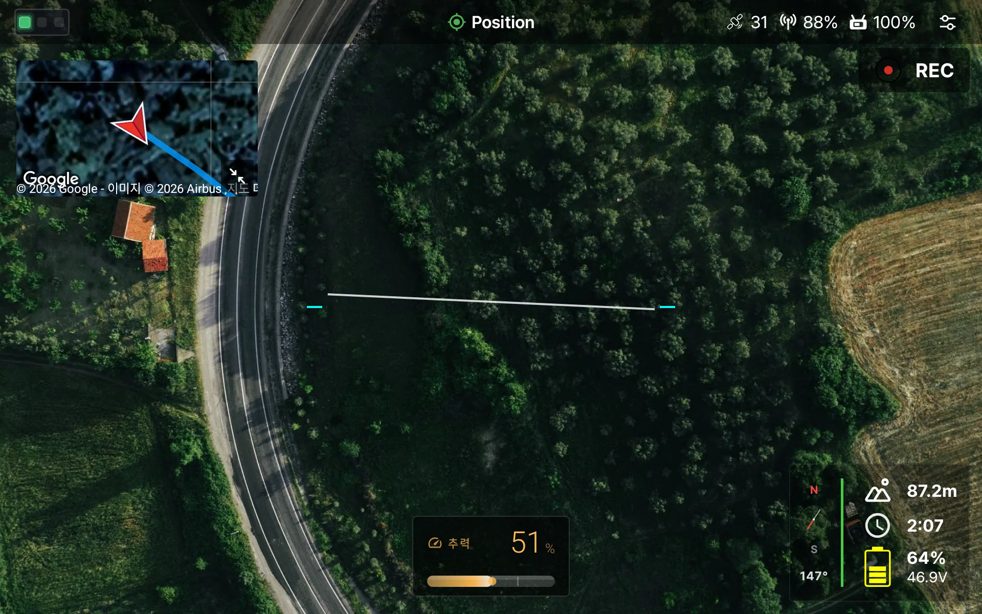
Live HUD — map PIP, attitude line and flight data arranged over the video.
Danger arrives first,
on screen and by voice
Distances to detected obstacles are drawn over the video as a ribbon per direction, with a forward distance readout.
Aircraft faults and limit violations appear as a banner at once.
Important changes are spoken in Korean, English or Japanese, even when you cannot look at the screen.
Total weight is estimated live from thrust data, and a descent is advised when it exceeds the official propulsion table.
When the signal drops, the last values are frozen and needless alerts stop. When the same aircraft returns, the app re-requests what it needs and carries on.
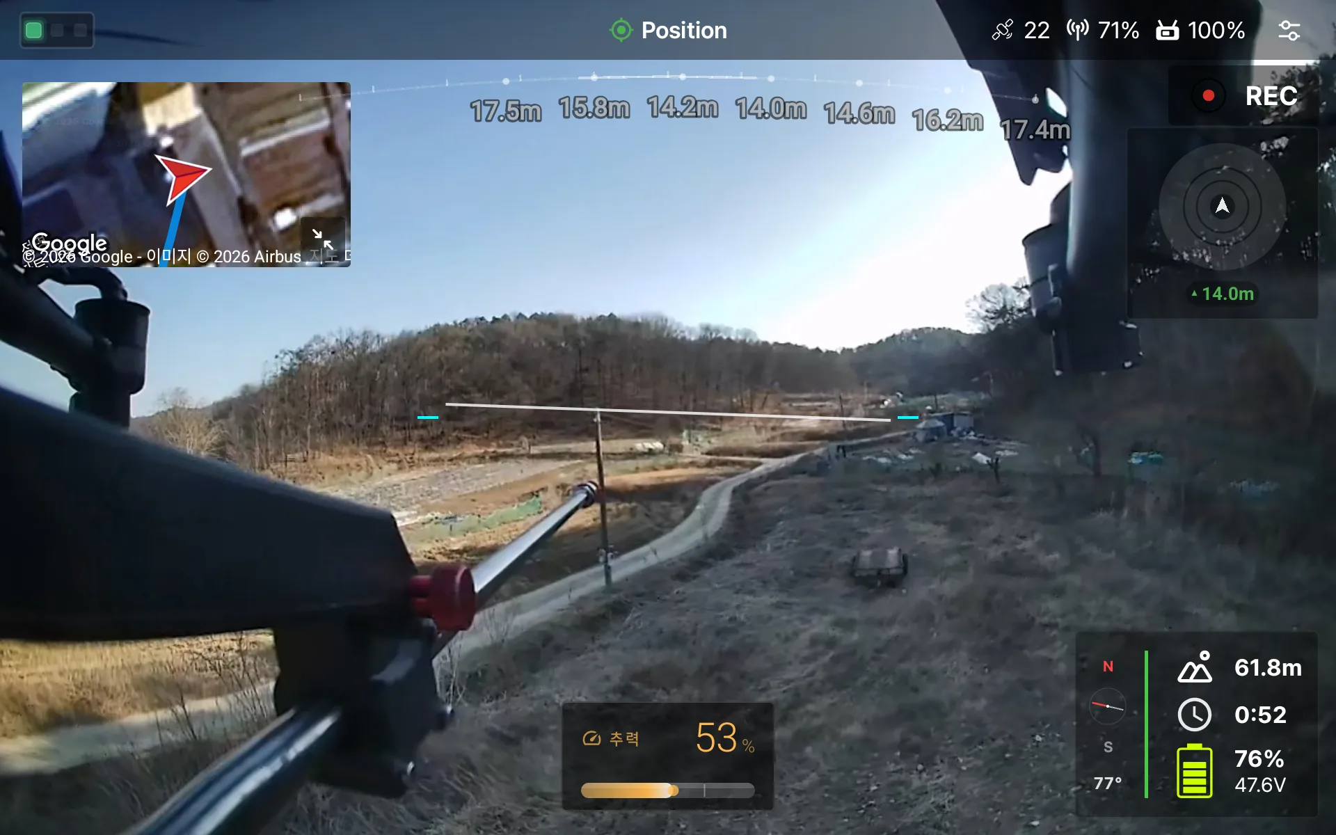
Forward obstacle ribbon and direction radar
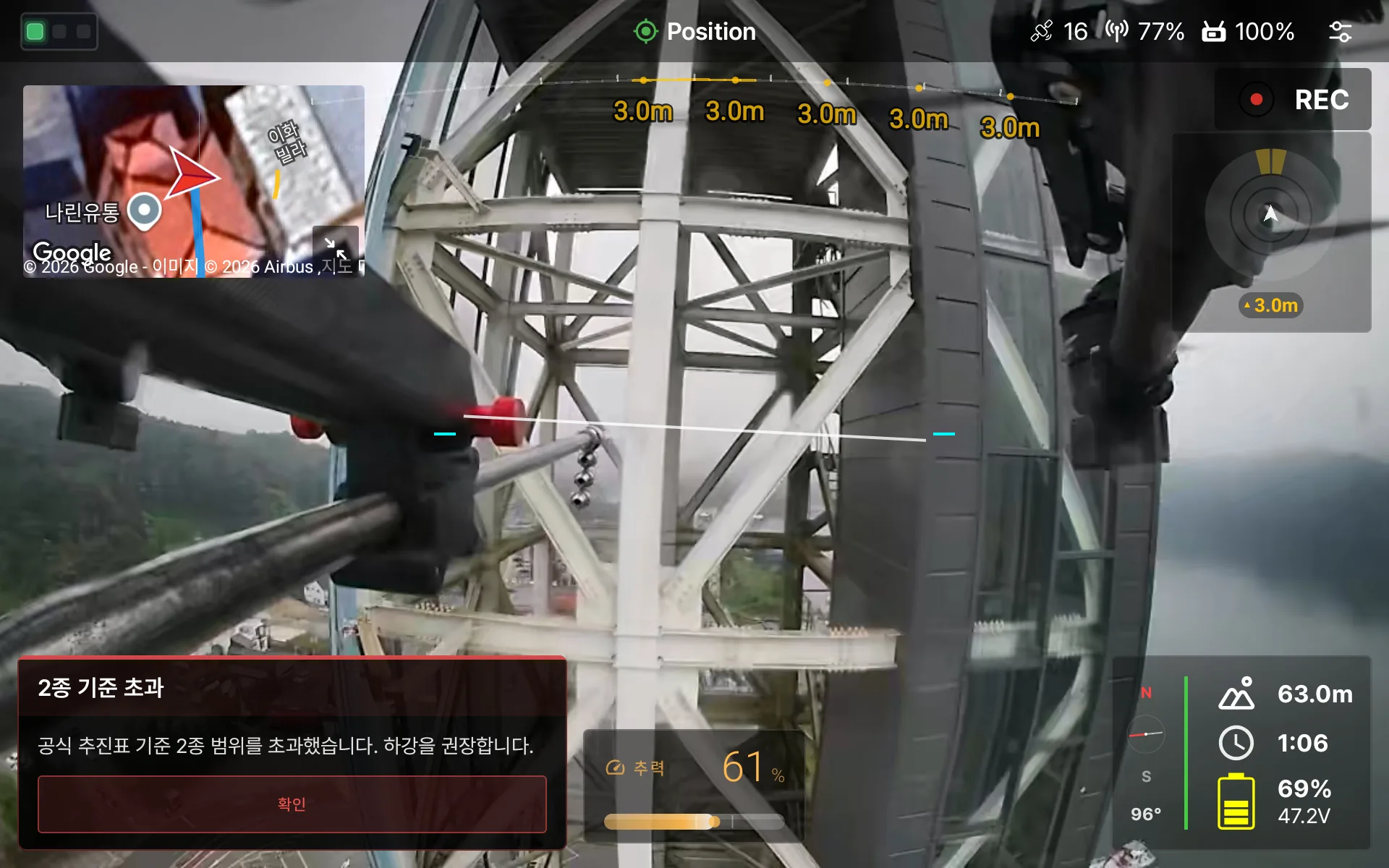
Propulsion table exceeded — descent advisory
Track and airspace
at a glance
Live position and the path flown stay on the map. No-fly and controlled airspace are color coded, so you can tell whether you are in a flyable zone without any other source. With several aircraft, each one gets its own color on the map and the selector at the top switches which one you control.
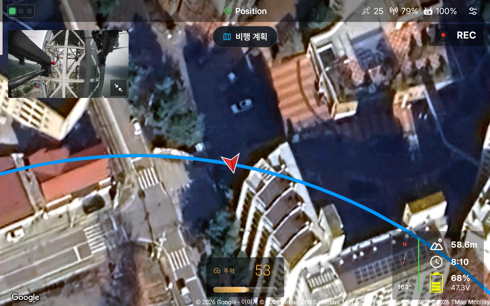
Main map with the path flown — video stays visible as PIP.
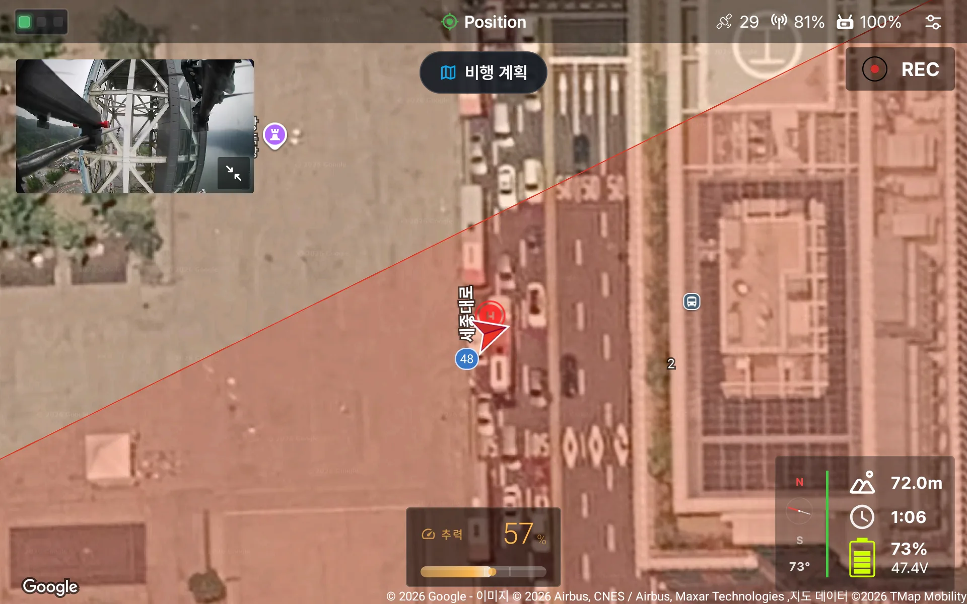
No-fly zones are color coded on the map instantly.
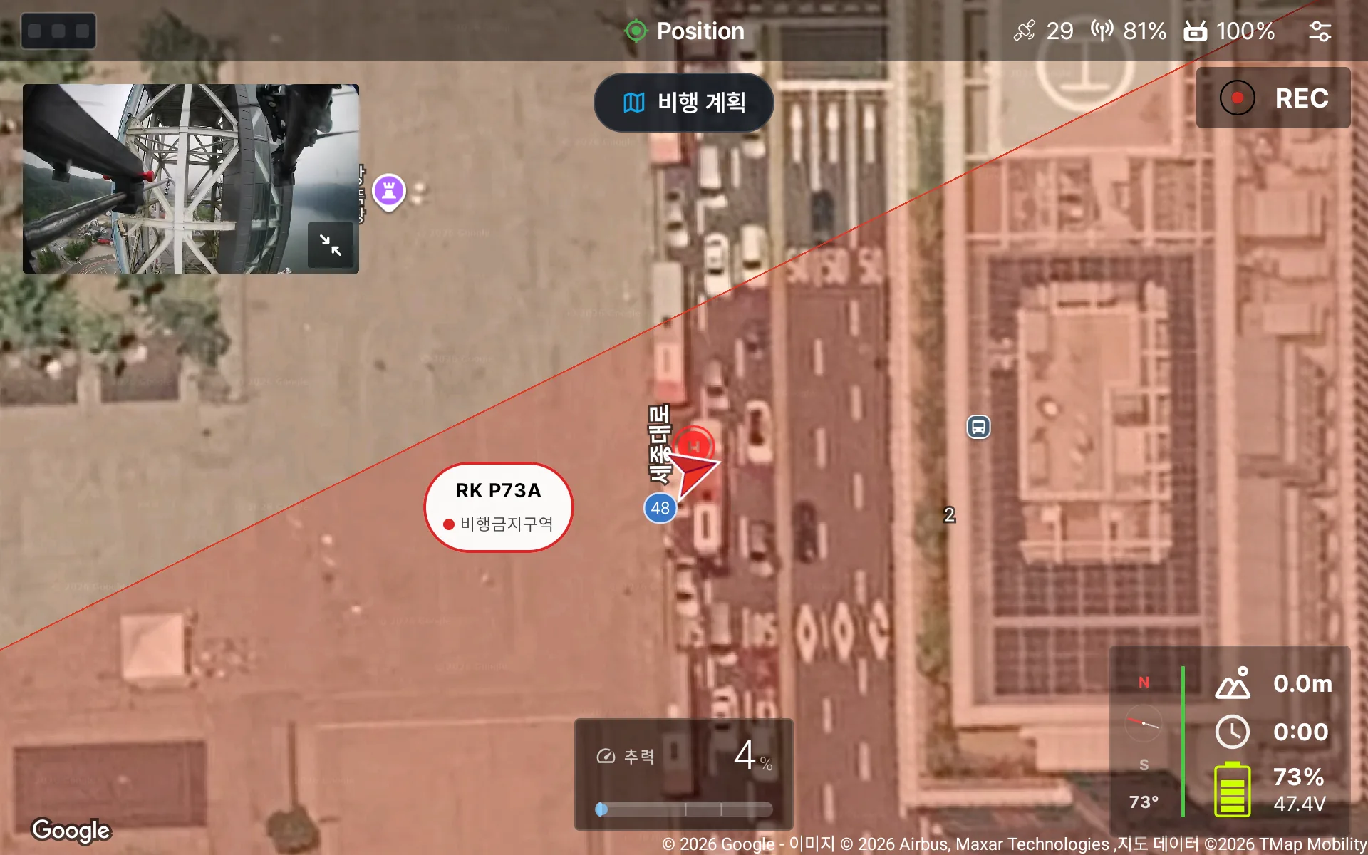
Long-press for the zone name and class.
Every screen on this page is
what DRTView actually shows.
Features grew
in the field
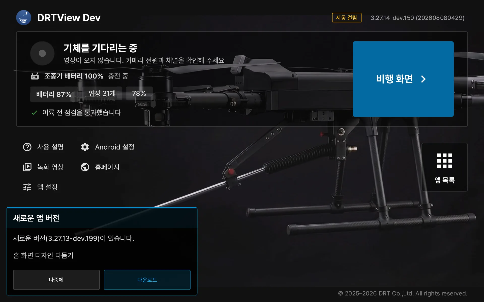
New version notice on the home screen — one tap to update
The app, and the aircraft parameters too, stay current over an internet connection.
The telemetry of every flight is stored on the controller automatically. When online, it uploads to the DRT server as the basis for remote diagnosis.
Received video is saved at original quality without re-encoding, and can be reviewed on the controller.
Pull the flight logs stored on the aircraft to the controller for analysis and maintenance decisions.
A wizard guides stick calibration and channel and function assignment. Joysticks work the same way.
Simple to start,
precise to the end
Each aircraft has its own settings screen. DRT Q gets a feel editor with presets and response curves. Go deeper and all 1,000+ PX4 parameters open up with groups and search, parameter files show what will change before they are applied, and motors and servos can be tested one by one. Values are written to the aircraft exactly as entered.
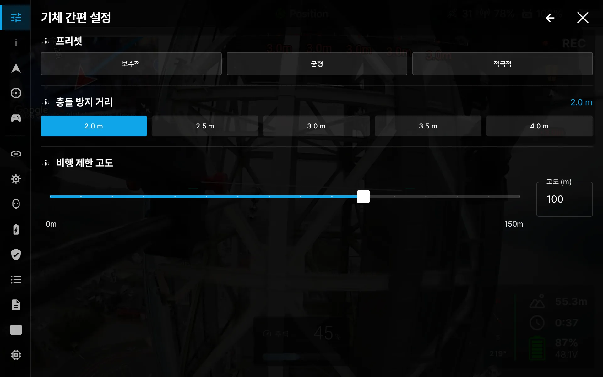
Quick setup — presets · collision distance · altitude limit
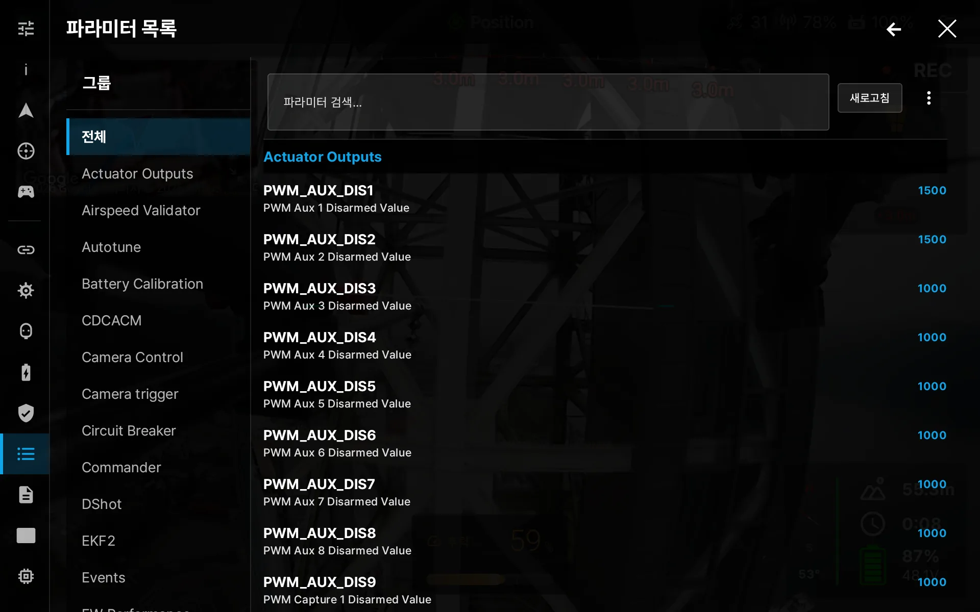
Full parameter list — groups and search
Built for DRT aircraft,
standard gear welcome
DRT Native
NEXA1, DRT Q and other DRT aircraft are fully integrated, down to dedicated hardware, mission features and per-model settings screens.
Standard FC
Connects to PX4-family flight controllers over USB, UDP, TCP and Bluetooth. Attach several links and the primary switches over by itself; MAVLink signing protects commands.
Android Controller
Runs on Android controllers and tablets such as MK15, RC7 and UniRC 7.
Three languages,
any site
Korean, English and Japanese are fully supported. As an in-house app, every screen is tuned for each language, and new languages are added quickly on partner request.

한국어
Default — warnings and voice prompts in field terms.

English
Global standard — for overseas operation and exported equipment.

日本語
For the Japanese market and local partners.
On a desk,
see it wider
The same app opens on a Windows PC, laid out for a big screen and a mouse. Draw a flight plan on the map and send it to the aircraft, use aerial imagery files as the map where there is no internet, and command several aircraft from one screen.
Place waypoints, loiters and points of interest on the map, and generate survey, corridor and structure scan patterns. Geofence and rally points upload with the plan.
Load GeoTIFF imagery and maps, stitch several files, and keep satellite and label tiles cached for use without internet.
Lay out the status of several aircraft on one screen and command one or all of them.
Your next flight,
with DRTView
Pre-installed on the controller included with DRT aircraft packages.